
Finding Eureka Residents Along a Street
A careful Eureka street directory search follows one address through several custodians. Humboldt County's property inquiry supplies the assessment number and APN. GIS shows the parcel and its neighbors. The Recorder then uses a person's name, rather than the street, to find the deed chain. Historical reverse directories can turn an address into a reported occupant, but only for the years and communities that the volume covered.
Walk the trail in order. Save the exact street suffix, ZIP, cross streets, APN, document number, and directory year. A name found at one step is a clue for the next step, not a final statement about who lives there.
- Enter all or part of the street address in the Humboldt Property Assessment Inquiry and open the matching assessment number.
- Copy the full APN, then search the county GIS and the Eureka Community Development map to check parcel shape, boundaries, and local layers.
- Use the authorized assessment or counter channel to identify the current assessment owner when the public detail does not expose it.
- Search the Recorder under the owner's last name and first name, repeat spelling variants, and capture the acquisition deed's grantor, date, and legal description.
- For an older address, read the reverse directory from 1913 onward, then compare the occupant with a directory, census, newspaper, deed, or obituary.
Eureka Property Inquiry by Address
The county property portal is the main address key in a Eureka street directory. Its Search Type choices are Assessment Number, Fee Parcel Number, and Street Address. Street Address accepts a full or partial string, which makes it possible to browse a run of parcels along a street. Parcel searches accept a full number such as 123-456-789-000 or a shorter prefix. Hyphens are optional, and books 001 through 009 need leading zeros.
Humboldt does not offer an online owner-name search. The portal's role is to locate current assessment information and a parcel map, not to display a complete household. If an exact detail field is not shown, ask the Assessor at 825 Fifth Street, Room 300, or call 707-445-7663. Characteristics are maintained for assessment purposes and are not continuously updated.
The county search instructions support the field sequence below.
| Field or control | Type | Required | What the Eureka search permits |
|---|---|---|---|
| Search Criteria | Text | Yes | Assessment number, fee parcel number, or all/part of a street address |
| Search Type | Dropdown | Yes | Assessment Number, Fee Parcel Number, or Street Address |
| Assessment or fee parcel number | Text | Conditional | Use the full four-part number or a documented prefix for range browsing |
| Street address | Text | Conditional | All or part of the address; double-click an assessment result |
| Button | Optional | Available at the top of the detail data window |
Save the APN even when the street label looks clear. It is the bridge to GIS and a stronger continuity key than a postal line.
Eureka GIS Parcel Browsing
County Web GIS supports address or parcel-number search in every application, then lets a researcher pan, zoom, and click outward from the subject parcel. Depending on the application, layers include parcels, aerials, flood, slope and topography, fire, airport compatibility, coastal jurisdiction, streamside areas, agricultural soils, and MS4 areas. The city map supplies Eureka parcels, zoning, boundaries, and local land-use context that the county map omits inside the incorporated city.
GIS is a planning aid, not a survey. Humboldt warns that mapped positions may be off by about 50 feet in urban areas and 400 feet in rural areas. Click the parcel to capture its APN, then take that identifier to the Assessment Inquiry. For a block search, click the lots beside, behind, and across the street, and compare the aerial with the parcel outline before assuming that the nearest street number is legally adjacent.
The Humboldt GIS launch page and Web GIS limitations page explain the county map. The Eureka GIS map supplies the city side of the question.
The Humboldt Assessor page explains the parcel and assessment role behind the address search.
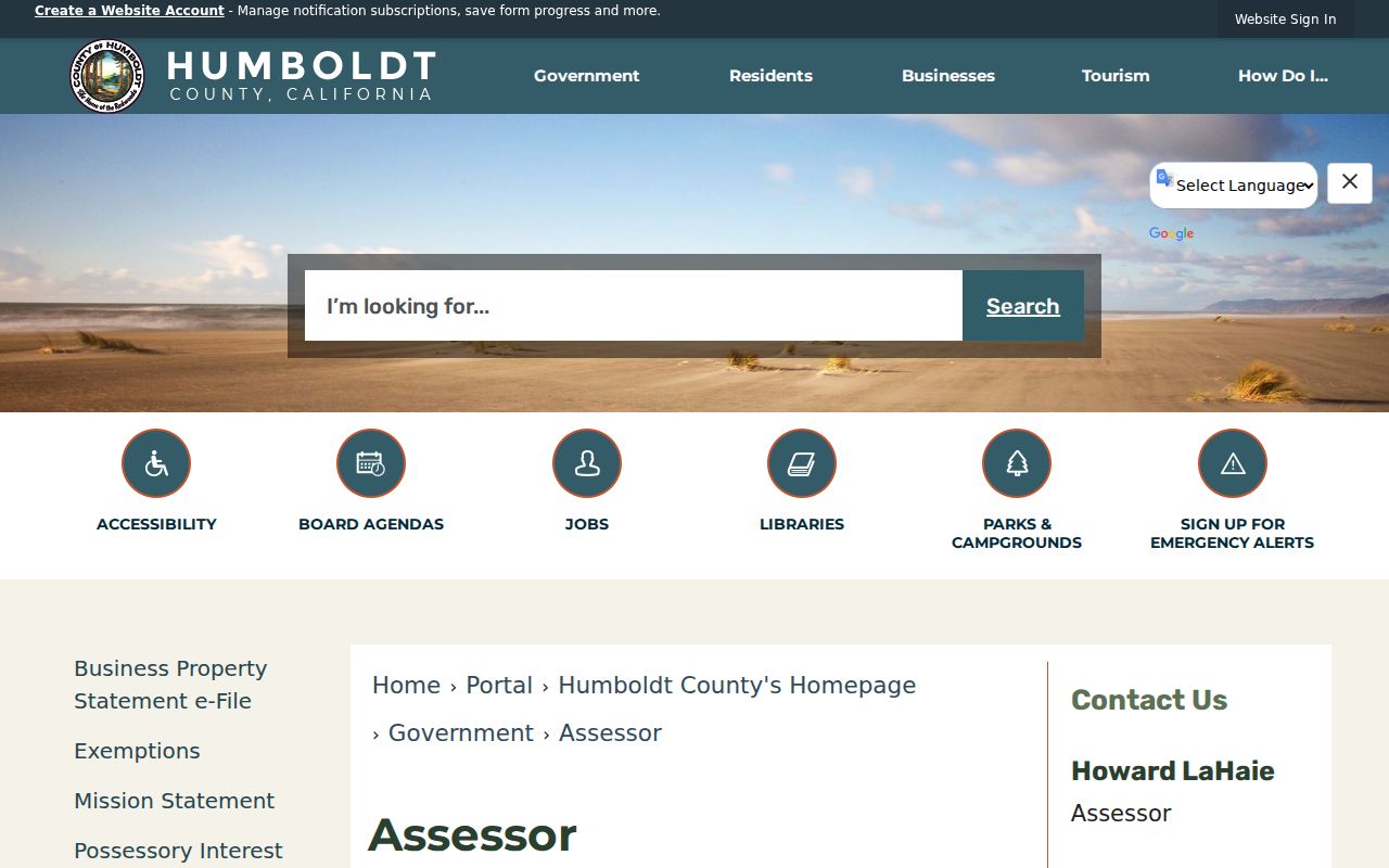
The assessor entry point shown here starts the parcel chain. The map step adds shape and jurisdiction before a name is carried to the Recorder.
- Parcel
- A mapped unit used by the Assessor to organize land and assessment data.
- Situs address
- The physical location assigned to the parcel; it is not the same as a tax mailing address.
- Plat
- A recorded map that helps connect lots, blocks, subdivisions, and parcel geometry.
- Criss-cross directory
- An address-first or street-order directory that moves from a known location toward a reported occupant.
Eureka Street Records by Address
The address record sets in Eureka overlap, but they do not answer the same question. A parcel inquiry finds an assessment unit. A deed names parties to a recorded interest. A permit can show a project and an applicant. A reverse directory reports an occupant for a publication year. The street directory becomes useful when those roles are kept distinct.
| Record set | Address key | What it supplies | Access path |
|---|---|---|---|
| Assessment inquiry | Street address or APN | Assessment number, parcel context, current assessment record | Free county search; no owner-name query |
| County Web GIS | Address, APN, mapped parcel | Parcel shape, nearby APNs, aerial and hazard context | Free map; land-use limits inside Eureka |
| Recorder index | Party name, document, book/page | Deed, lien, reconveyance, map, date, and legal-description trail | Free index; images and copies have fees |
| Eureka planning file | Address, APN, project | Permit or application dates, scope, and named public participants | Development Services or focused request |
| Historic reverse directory | Street number and publication year | Reported occupant, nearby listings, and sometimes telephone context | Library, Society, or Cal Poly collection |
| Voter file | Residence and permitted research purpose | Restricted election information, not a public roster | California request rules apply |
The APN ties the assessment and map together. The legal description ties a deed to the land when a street label changes. The directory year ties an occupant clue to a publication scope. These are different links in one address chain.
Eureka Street Grid and Address Keys
Central Eureka's historic grid makes cross-street checks useful. Numbered streets generally run east-west and alphabetic streets run north-south in the Downtown and Old Town core. Eureka Main Street describes its district as A through I Streets and the waterfront through Eighth Street. Named roads, alleys, curving subdivisions, and unincorporated Cutten do not follow one simple pattern.
A street number in a directory is not automatically today's situs. Keep the block, cross streets, APN, lot or block description, and Sanborn footprint together. The city and county do not publish one verified, citywide street-renumbering chronology in the research, so a suspected change must be tested through directories, recorded maps, the City Clerk, Development Services, and GIS. Do not turn a mismatch into a claimed move.
The Eureka Main Street description gives a local orientation point, while the County Surveyor explains why a GIS line is not a survey corner.
Eureka Permits at a Street Address
Development Services can add a change-over-time layer to a Eureka street directory. A planning or building file may name an address, APN, project scope, application date, owner, applicant, contractor, or design professional when that information is public and unredacted. It can show when work was proposed and whether a later remodel, demolition, or replacement interrupts the apparent continuity of a structure.
The City routes current planning applications through a free-account OpenGov channel, but the research did not establish a complete online permit or code-case search, a coverage start date, or the full public result fields. For an older property, give Development Services the street address, APN if known, approximate project date, and requested record type. Planning is at 531 K Street, with Planning at 707-441-4160 and Building at 707-441-4155.
Use the City Development Services page for the current office route. A permit is evidence of a project, not proof that every named person occupied the site.
Eureka Reverse Directories Since 1913
Ordinary directory work moves from a surname to an address. Eureka's reverse or householder material can move in the other direction. The Historical Society account identifies 1913 as the practical start of address, telephone, or combined reverse searching. Read the street-order entry and the nearby numbers, then compare the name with a deed, census, obituary, newspaper, or another directory year.
The reverse section is especially useful when an old house is known but the occupant is not. It still reflects the volume's geographic scope. The 1952 run narrows from county coverage to selected communities, the 1970 run changes again, and from 1991 the cited series is Eureka alone. A person can disappear because the book changed its footprint, not because the household left Humboldt County.
The complete shelves and publishers are described in the Eureka city directory collections. On the street directory side, preserve the volume title, page, street number, and nearby entries as one citation.
Eureka Deed History Before 1979
The online Recorder index is not the whole Eureka title trail. It covers 1979 to the present, and web-purchasable noncertified images start April 9, 1999. Pre-1979 work moves to the bound alphabetical index books at the Recorder lobby. A visitor may examine the index without an index-search fee, then take the instrument number or book-and-page reference to the copy counter.
For copies, the county lists $2 for the first page, $1 for each additional page, $2 for certification, and $7 for the first map page with $5 for each additional map page. The official copy request form accepts repeated record-identification lines and delivery choices by email or mail. Certified copies cannot be emailed. Staff do not perform a title search, so the researcher must supply the reference.
Pre-1979 is an offline boundary, not an absence of records. The library, Historical Society, Cal Poly shelves, maps, newspapers, and archival request channels can bridge the gap when the bound books do not settle an address question.
Eureka Voter Files by Street
A California voter file cannot be used as an open Eureka street directory. The My Voter Status application authenticates one person with private identifiers. A fuller file request asks for a lawful election, scholarly, journalistic, political, or governmental purpose, identity documentation, security promises, and a signed certification. The state rules allow up to ten specific voters in one application, but that is a regulated request, not casual browsing.
Even permitted voter information has boundaries. Driver-license and identification numbers, Social Security numbers, signatures, protected addresses, and Safe at Home records remain confidential. Participation history never shows a ballot choice. Registration status changes as notices, address updates, duplicate records, and list maintenance occur, so a dated election record is not a guarantee of current occupancy.
For the exact current route, use California voter-file instructions or call Humboldt Elections at 707-445-7481. A street search should rely on parcels and historical directories unless the requester qualifies for the restricted file.
Limits on a Eureka Street Directory
A street directory can identify a parcel, a recorded interest, a project file, or a historical directory entry. It cannot enumerate renters, children, roommates, guests, utility customers, delivery recipients, or every person who happens to be present. A tax mailing address can point away from the parcel, and a situs address can point to land without proving owner occupancy.
DMV address data is protected by federal law. Utility records are not a public substitute. Safe at Home can replace a qualifying participant's public address with a designated one. When a name appears in a public index, use it to find the source record and check the role, date, and address rather than publishing a household list.
Lawful personal use. Eureka street and address records can support family history, property research, and civic questions. Using them to stalk, harass, intimidate, or harm anyone is unlawful, and a protected address must not be reconstructed from other records.
For a one-person question, shift to the Eureka resident lookup workflow. It keeps name matching, role, and source verification separate from the whole-street record chain.